The Camins de l'Aigua (Water Trails) represent a network of easy, family-friendly walking routes throughout the Berguedà comarca that follow rivers, streams, and springs while exploring the region's rich industrial heritage related to water power. These accessible trails range from 1 to 3 hours in length and showcase the intimate relationship between mountain communities and their water resources. You'll discover historical mills, traditional fountains, hydroelectric installations, irrigation channels, and the natural beauty of Berguedà's rivers and streams. The network includes over a dozen different routes, each focusing on a specific valley or watershed, making it possible to explore different trails over multiple visits. Spring and early summer are particularly beautiful when water flow is highest and wildflowers bloom along the riverbanks.
The Water Trail Network
The Camins de l'Aigua network was developed by the Berguedà County Council to preserve and promote the region's water-related cultural heritage while providing accessible outdoor recreation. Each trail is well-marked with distinctive blue signage featuring a water droplet logo, and interpretive panels (usually in Catalan, Spanish, and English) explain points of interest along the route.
Popular trails include the Camí de l'Aigua de Vallcebre, which follows the Bastareny River through a dramatic gorge; the Camí de l'Aigua de Gironella, exploring the Llobregat River and historical textile mills; and the Camí de l'Aigua de Bagà, visiting springs and fountains around this charming medieval town. Each route has its own character—some follow gentle valley floors while others climb hillsides to reach springs, some focus on natural beauty while others emphasize industrial archaeology.
The trails are generally circular or out-and-back routes ranging from 3 to 10 kilometers, with minimal elevation gain (usually less than 200 meters). This makes them suitable for families with children, older visitors, or anyone looking for a relaxed walk rather than a strenuous hike. Most trails can be walked in comfortable walking shoes rather than requiring hiking boots, though footwear with good grip is advisable as paths near water can be slippery.
Rivers and Watersheds
The Berguedà comarca is defined by its rivers, primarily the Llobregat and its tributaries. The Llobregat is one of Catalonia's major rivers, rising in the high Pyrenees and flowing through Berguedà on its journey toward Barcelona and the Mediterranean. The water trails follow various reaches of this river system, from high mountain streams fed by snowmelt to broader valley rivers that once powered industry.
The character of the rivers changes dramatically with the seasons. Spring (April-June) brings high water from snowmelt and rainfall, creating spectacular flow through gorges and over waterfalls. This is the most dramatic time to walk the trails, though be aware that some sections may be impassable if water is exceptionally high. Summer sees flow decrease significantly, but lower water reveals rocky riverbeds and creates calm pools perfect for cooling off (though official swimming is not encouraged on most trails for safety and conservation reasons).
Autumn can bring renewed flow after September rains, and the riverside vegetation turns beautiful colors. Winter is the quietest season with lowest flow, but the trails remain accessible and offer a different kind of beauty—frost-covered vegetation, crystal-clear water, and the possibility of seeing icicles hanging from cliffs in the gorges. The rivers support diverse aquatic life including trout, water insects, and amphibians like fire salamanders and midwife toads. Patient observers might spot grey wagtails, dippers, or kingfishers along the water.
Industrial Heritage and Water Power
For centuries, the rivers of Berguedà powered a thriving industrial economy based on water mills. The water trails pass numerous examples of this heritage, from simple grain mills (molins fariners) that ground wheat and corn for local consumption, to larger industrial installations including textile mills, sawmills, and even early hydroelectric plants. Understanding this heritage adds fascinating historical context to the walks.
Traditional water mills used a simple but effective technology—water diverted through channels (rescloses or sèquies in Catalan) drove wooden wheels connected to millstones. Many trails follow these historical channels, which are engineering marvels in themselves, maintaining gentle gradients across kilometers to deliver water to mills. Some channels are still functional and continue to carry water, while others have been abandoned and are gradually being reclaimed by vegetation.
The late 19th and early 20th centuries saw the arrival of hydroelectric power, and several trails visit early power plants that generated electricity for local industry and towns. The Camí de l'Aigua de Guardiola, for example, passes a beautifully preserved hydroelectric station from the 1920s with original turbines and equipment. These installations represent the transition from traditional to modern industry and the beginning of the electrification that transformed rural Catalonia.
Interpretive panels explain the technical details and social importance of these installations. Mills were community gathering places where farmers brought grain and exchanged news. The miller (moliner) was an important figure in village life. Women came to wash clothes at water sources using stone wash-basins (safareigs) that can still be seen along some trails. This rich social history is embedded in the landscape for those who know how to read it.
Springs, Fountains and Water Sources
In addition to rivers, the water trails highlight the importance of springs and fountains (fonts) in mountain communities. Before modern plumbing, these sources provided drinking water and were essential to survival. Many trails visit particularly significant springs, often marked by traditional stone fountains with inscriptions indicating when they were built and sometimes by whom.
The fonts often have religious or legendary associations. Some are dedicated to saints and were believed to have healing properties—particularly for eye ailments or skin conditions. Others are associated with local legends about shepherds, bandits, or supernatural beings. The Camí de l'Aigua de Saldes, for instance, visits several fonts with interesting stories, creating a walk that combines natural beauty with folklore.
From a natural history perspective, springs reveal the hydrogeology of the region. Water falling as rain or snow on the mountains percolates through limestone bedrock, emerging at springs where impermeable rock layers force it to the surface. Spring water is typically cold (around 8-12°C year-round) and clear, often with high mineral content that creates colorful mineral deposits around the source. The constant temperature and flow create unique microhabitats supporting specialized plants like mosses, ferns, and saxifrages that thrive in the permanently moist conditions.
Flora and Riparian Ecosystems
The vegetation along water trails differs markedly from the surrounding forests and scrubland due to the constant moisture. Riparian (riverside) corridors support lush plant communities even in the dry summer months when hillsides turn brown. Trees including alder, willow, ash, and poplar line the waterways, their roots stabilizing banks and their leaves providing shade that keeps water temperatures cool for aquatic life.
The understory along the trails bursts with growth in spring and early summer. Look for ferns (particularly the large lady fern and hart's-tongue fern), wild mint, purple loosestrife, and meadowsweet filling the air with sweet fragrance. Climbing plants like honeysuckle and clematis drape over shrubs. This vegetative abundance creates excellent habitat for insects, which in turn attract birds—warblers, finches, and robins are common along the trails.
Some trails pass through particularly special plant communities. The Camí de l'Aigua de Vallcebre, for example, traverses sections of alder carr forest, a rare and valuable habitat in inland Catalonia. The wet conditions also support various orchid species in spring, and keen botanists might find rare ferns and mosses in the gorges. The biodiversity of riparian corridors makes them disproportionately important for conservation despite their relatively small area.
Practical Information for Visitors
Each water trail has a designated starting point, usually in or near a village with parking available. Detailed trail descriptions and maps can be downloaded from the Berguedà County Council tourism website, or picked up from tourist information offices in Berga and other larger towns. The trails are well-signposted on the ground, but having a map or downloaded route on your phone provides reassurance and helps you identify points of interest.
Most trails can be walked year-round, though spring (April-June) is optimal when water flow is highest and temperatures are pleasant. Summer can be hot in the valleys but the tree shade along rivers provides relief. Autumn offers beautiful colors and good weather. Winter is quiet and atmospheric, though some higher trails may be icy. After heavy rain, check conditions as some sections near rivers may flood temporarily.
Appropriate footwear is important—while these are easy trails, sections can be muddy or slippery, especially near water. Comfortable walking shoes with good grip are sufficient for most trails in dry conditions, but light hiking boots provide better support and water resistance. Bring water and snacks, though the short duration means extensive supplies aren't necessary. Insect repellent can be useful in summer as mosquitoes and flies breed near water.
These trails are excellent for families with children. The combination of water, industrial heritage, and relatively short distances keeps kids engaged. Some trails pass through villages where you can stop for refreshments, adding a social element to the walk. Consider combining a morning water trail with lunch in a village restaurant serving traditional Berguedà cuisine—an ideal way to experience both the natural and cultural heritage of this fascinating region.
Practical information
1-3 hours per trail
Easy
Spring and early summer
15-35 km (15-40 min)
700-1,300 m
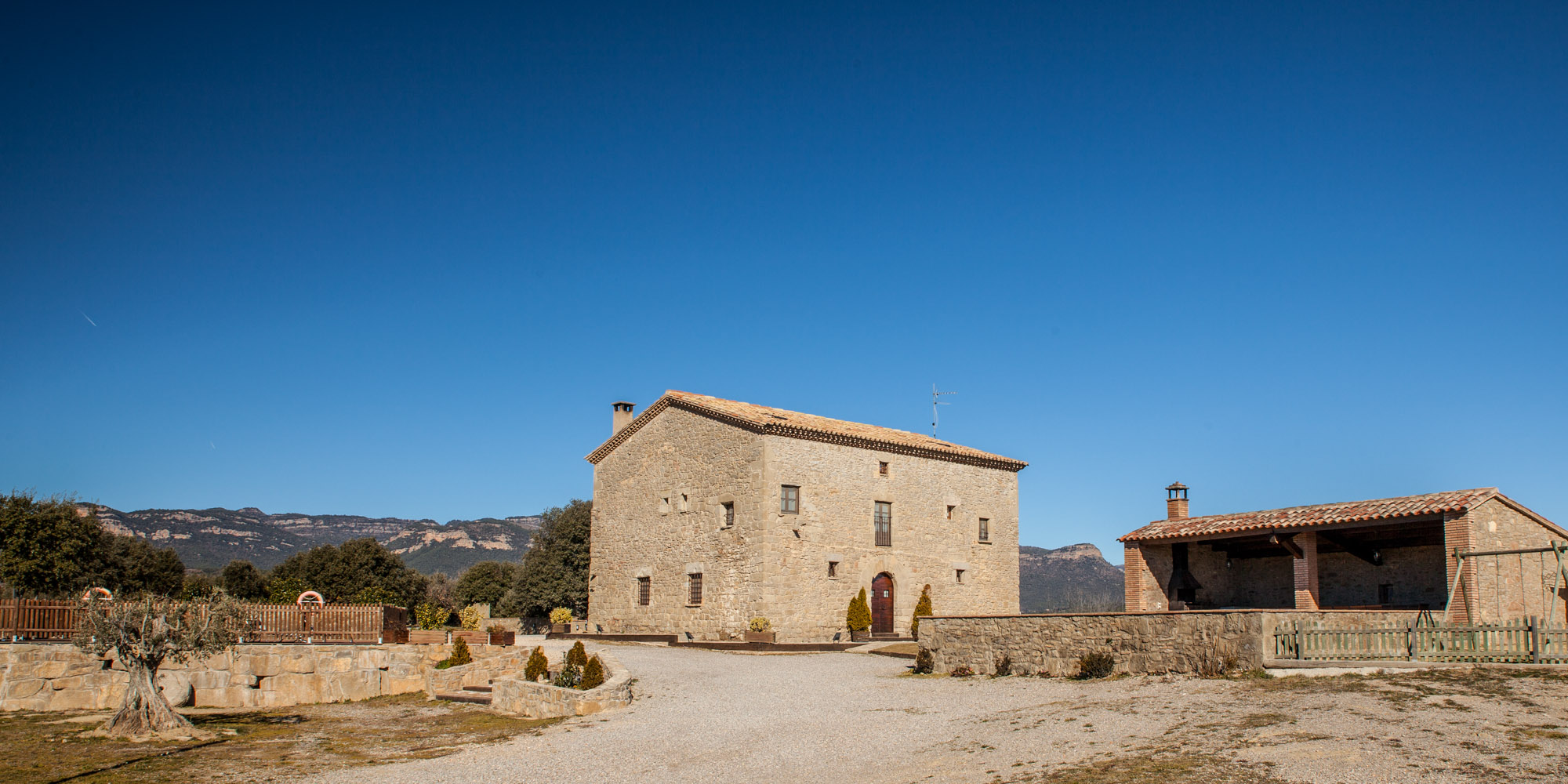
Discover Berguedà from La Tor de Montclar
15th-century farmhouse with indoor pool, ideal for groups of up to 20 guests
Check availability