The GR 150 Sender del Berguedà is a magnificent long-distance circular trail that takes hikers on a complete tour of the Berguedà comarca in the Catalan Pre-Pyrenees. Covering approximately 180 kilometers and typically divided into 9 to 12 stages, this trail is an immersive journey through one of Catalonia's most beautiful and historically rich mountain regions. The route passes through medieval villages, crosses high mountain passes, traverses ancient forests, and visits some of the area's most iconic natural landmarks including Pedraforca, the Serra del Cadí, and the headwaters of the Llobregat River. Whether you walk the entire circuit or choose individual stages, the GR 150 offers an authentic experience of Catalan mountain culture, landscapes, and traditions.
Understanding the GR 150 Route
The GR 150 is part of Spain's extensive Gran Recorrido (GR) network of long-distance footpaths, identified by red and white horizontal stripe waymarks. The circular nature of the route means you can theoretically start anywhere along its length, though most hikers begin in Berga, the comarca's capital, or in one of the larger villages with good transport connections.
The trail has been carefully designed to showcase the geographical and cultural diversity of Berguedà. It climbs from valley floors around 700 meters to high mountain passes above 2,300 meters, passes through different vegetation zones from Mediterranean-influenced oak forests to alpine meadows, and connects historic villages that have preserved their medieval architecture and mountain traditions.
Individual stages vary from 12 to 22 kilometers, with most taking between 4 and 8 hours to complete. The trail is generally well-maintained and marked, though some high mountain sections require good navigation skills and appropriate mountain experience. Total elevation gain for the complete circuit is approximately 9,000 meters, roughly equivalent to climbing from sea level to the summit of Everest - though obviously spread over many days and with lots of descents too.
Key Stages and Highlights
While every section of the GR 150 has its own character and appeal, certain stages are particularly memorable. The stage that passes near Montclar, very close to La Tor, offers beautiful rolling terrain through mixed forests and traditional farming landscape, with the dramatic backdrop of the Serra del Cadí visible to the north.
The high mountain stages are the most spectacular and challenging. The section crossing the Serra de Cadí via the Coll de Pendís (2,285 m) provides breathtaking views and a true alpine experience. The stage that circumnavigates Pedraforca overlaps with the dedicated Volta al Pedraforca route and is consistently rated as one of the finest day hikes in Catalonia.
Lower elevation stages have their own charm. The trail follows sections of the Llobregat River, passes through the stunning natural pools and waterfalls of the Fonts del Llobregat, and winds through medieval villages like Bagà with its impressive fortified walls, Gósol with its Picasso connections, and numerous smaller hamlets where traditional life continues much as it has for centuries. Many stages pass Romanesque churches, some dating back to the 10th and 11th centuries, with beautiful stone architecture and medieval frescoes.
Walking Options: Complete Circuit or Selected Stages
Completing the entire GR 150 is a significant undertaking that most hikers spread over 9 to 12 days, depending on their pace and how they divide the stages. This makes for an exceptional multi-day adventure, offering deep immersion in the mountain landscape and the chance to experience the rhythm of long-distance hiking. However, the circular nature and good access from multiple points make the trail equally suitable for day hikers wanting to experience selected stages.
Many hikers focus on the high mountain stages during good weather periods, combining several into a 3-4 day trek with overnight stays in mountain refuges or villages. Others prefer the lower, more forested sections during hot summer months when the shade and lower elevations are more comfortable. Spring and autumn are ideal for longer sections when temperatures are moderate and the trails less crowded.
The trail passes through or near numerous villages with accommodation, from basic mountain refuges to comfortable rural hotels and guesthouses. This means you can hike with just a daypack, arranging accommodation and meals as you go. Alternatively, camping is possible in designated areas, allowing for more flexibility but requiring you to carry full backpacking gear.
Natural Environment and Wildlife
The GR 150 traverses through remarkably diverse ecosystems, a function of the significant altitude range and the region's position between Mediterranean and Atlantic climate influences. Lower elevations feature holm oak forests, giving way to mixed deciduous forests of oak, beech, and chestnut at mid-elevations. Higher up, coniferous forests of Scots pine and black pine dominate, before thinning out to alpine shrubs, grasses, and rocky terrain above the treeline.
This habitat diversity supports an equally varied fauna. The forests are home to wild boar, red deer, roe deer, and foxes, while the high mountains provide habitat for chamois (isards) and marmots. Birdlife is exceptional, with golden eagles, bearded vultures, griffon vultures, and peregrine falcons among the raptors you might spot. Spring and summer bring an explosion of wildflowers, with different species dominating at different elevations - from wild orchids and gentians to edelweiss and saxifrages in the highest zones.
The trail passes through several protected natural areas including parts of the Cadí-Moixeró Natural Park, which encompasses over 41,000 hectares of mountain terrain. These protected areas have helped preserve both the natural environment and traditional land management practices that have shaped the landscape over centuries.
Cultural and Historical Significance
Walking the GR 150 is not just a nature experience but a journey through centuries of Catalan mountain history and culture. Berguedà has been inhabited since prehistoric times, and the trail passes numerous archaeological sites, medieval bridges, Romanesque churches, and traditional mountain architecture that tell the story of how people have adapted to and shaped this challenging environment.
The region's economy historically depended on sheep and cattle herding, charcoal making, and mining. Evidence of these traditional activities is visible throughout the route - old shepherds' huts, charcoal-making platforms (called sitges), and abandoned mine workings. Many villages along the route maintain small ethnographic museums documenting these traditional ways of life.
The trail also reflects the region's religious and architectural heritage. Berguedà contains one of Europe's highest concentrations of Romanesque art and architecture, with dozens of churches dating from the 10th to 13th centuries. Several stages of the GR 150 incorporate visits to these churches, many featuring original stone work and some preserving fragments of medieval frescoes. This combination of natural beauty and cultural richness makes the GR 150 a holistic experience of the Catalan Pyrenees.
Practical Information and Planning
The GR 150 can be walked from April through November, with July and August being the busiest months. Spring (May-June) offers wildflowers and flowing streams, while autumn (September-October) provides stable weather, fewer hikers, and beautiful foliage. The high mountain passes may retain snow into June and can see early snow from October onward, requiring appropriate equipment and experience.
Adequate physical preparation is essential for multi-day hiking, even if you're not carrying a full backpack. Start training several months before, gradually increasing the distance and elevation gain of your training walks. For the complete circuit, most hikers should be comfortable with daily stages of 15-20 kilometers including 600-1,000 meters of elevation gain.
Detailed maps and guidebooks for the GR 150 are available in Catalan and Spanish, with some English resources also available. The trail is generally well-marked, but carrying good maps and a GPS device or smartphone app is recommended. Weather can change quickly in the mountains, so always carry appropriate layers, rain gear, and emergency supplies regardless of the forecast.
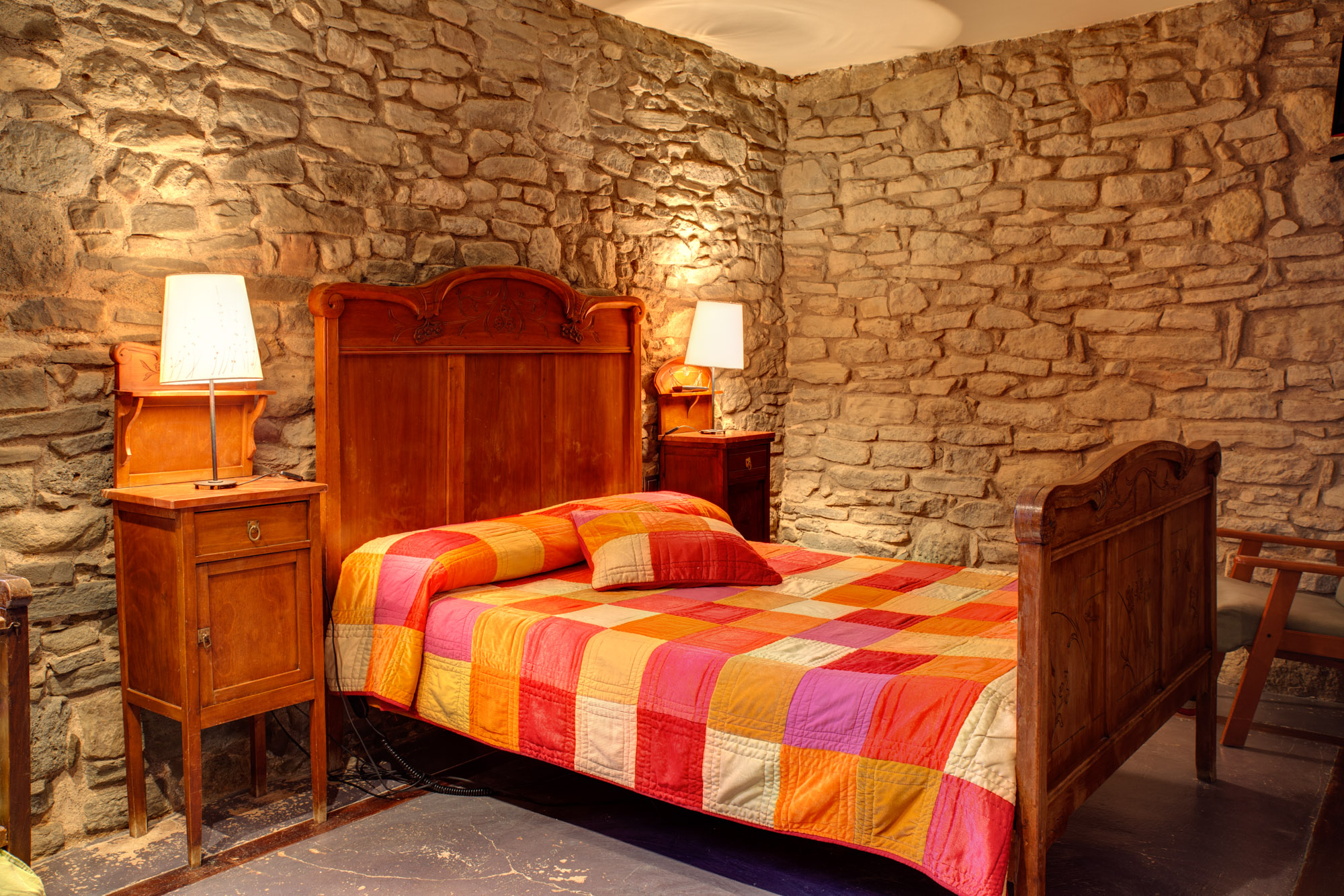
La Tor de Montclar is perfectly positioned along the GR 150 route, making it an ideal base for exploring different stages of the trail. Whether you want to complete the full circuit, walk several stages over a few days, or sample day hikes on selected sections, we can provide maps, current trail conditions, and local knowledge to help you plan your adventure. We're also happy to arrange luggage transfers or transport to different points along the trail.
Practical information
9-12 days (full circuit) or single stages
Moderate
April to November
0 km (passes near Montclar)
500-2,300 m
Discover Berguedà from La Tor de Montclar
15th-century farmhouse with indoor pool, ideal for groups of up to 20 guests
Check availability